Functional temporarily unavailable
Cities and villages of Chuhuiv district
Online travel guide to the settlements of Chuhuiv district
General information about Chuhuiv district
Chuguiv district is located in the central part of Kharkiv region, in the historical and ethnographic region of Slobozhanshchyna. The Seversky Donets River flows within the district. Forests on the banks of the Seversky Donets at the confluence of the Gomilsha River are protected by the Gomilshansky Forests National Nature Park with the popular recreational zone Koropovi Khutory. The lower part of the Gnilytsia river beam is covered by the territory of the Pecheneg Field Landscape Park.
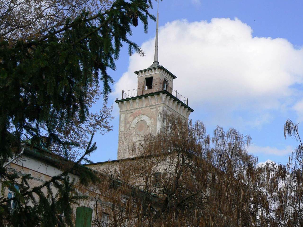
The administrative center of Chuguiv district is the city of Chuguiv, which preserves the architectural features of the ancient military settlement. The building of the Headquarters of military settlements is now part of the Historical and Memorial Museum of Ilya Repin, who was a native of Chuguiv. ...
Chuguiv district is located in the central part of Kharkiv region, in the historical and ethnographic region of Slobozhanshchyna. The Seversky Donets River flows within the district. Forests on the banks of the Seversky Donets at the confluence of the Gomilsha River are protected by the Gomilshansky Forests National Nature Park with the popular recreational zone Koropovi Khutory. The lower part of the Gnilytsia river beam is covered by the territory of the Pecheneg Field Landscape Park.
The administrative center of Chuguiv district is the city of Chuguiv, which preserves the architectural features of the ancient military settlement. The building of the Headquarters of military settlements is now part of the Historical and Memorial Museum of Ilya Repin, who was a native of Chuguiv.
The area of the district is 4807 square kilometers. The population of the district exceeds 200 thousand people.
The Chuguiv district consists of 226 settlements, which are united into 9 territorial hromadas: Chuguiv, Vovchansk, Zmiiv city and Malynivska, Novopokrovska, Pechenizka, Slobozhanska, Starosaltivska and Chkalovska settlement amalgamated hromadas.
Чугуївський район розташований у центральній частині Харківської області, в історико-етнографічному регіоні Слобожанщини. В межах району протікає річка Сіверський Донець. Лісові масиви на берегах Сіверського Дінця при впадінні в нього річки Гомільши оберігає Національний природний парк "Гомільшанські ліси" з популярною рекреаційною зоною Коропові Хутори. Нижню частину балки річки Гнилиця охоплює територія Регіонального ландшафтного парку "Печенізьке поле".
Адміністративним центром Чугуївського району є місто Чугуїв, що зберігає архітектурні риси старовинного військового поселення. Будівля Штабу військових поселень зараз входить до складу Історико-меморіального музею Іллі Рєпіна, який був родом із Чугуєва.
Площа території району становить 4807 квадратних к ...
Чугуївський район розташований у центральній частині Харківської області, в історико-етнографічному регіоні Слобожанщини. В межах району протікає річка Сіверський Донець. Лісові масиви на берегах Сіверського Дінця при впадінні в нього річки Гомільши оберігає Національний природний парк "Гомільшанські ліси" з популярною рекреаційною зоною Коропові Хутори. Нижню частину балки річки Гнилиця охоплює територія Регіонального ландшафтного парку "Печенізьке поле".
Адміністративним центром Чугуївського району є місто Чугуїв, що зберігає архітектурні риси старовинного військового поселення. Будівля Штабу військових поселень зараз входить до складу Історико-меморіального музею Іллі Рєпіна, який був родом із Чугуєва.
Площа території району становить 4807 квадратних кілометрів. Чисельність населення району перевищує 200 тисяч осіб.
До складу Чугуївського району входять 226 населених пунктів, які об'єднані у 9 територіальних громад: Чугуївська, Вовчанська, Зміївська міські та Малинівська, Новопокровська, Печенізька, Слобожанська, Старосалтівська і Чкаловська селищні територіальні громади.